In this working package, a data management system will be developed to support time series analysis. This system (s. figure 1) is mainly based on a storage component (database) that can deal with spatial and temporal data and their metadata.
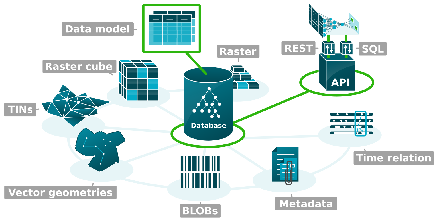
Besides SQL, the system provides a REST-based application programming interface (API) that supports methods for processing, joining, analyzing and transforming spatio-temporal data. This API is characterized by efficient, convenient, and interoperable access to data that data analysis operations need. The following categories of data are supported:
- Raster (tiled, pyramids, variable bands)
- Raster Cube (sequences of uniform rasters)
- Vector geometries (simple-feature-model)
- TINs (elevation model)
- BLOBs (binary data)
- Temporal data (including vague/rough time references)
- Metadata (description of data)
To support large-area data, approaches are evaluated, developed, compared and integrated to ensure efficiency for time-related analyses. The main component for managing data will be the object-relational and free database system PostgreSQL. By using the spatial extension PostGIS, the database system will be extended by data types to deal with raster-based data and vector geometries natively. Furthermore, for representing the different categories of spatio-temporal data, the data model is based on established standards as well as on results from a previously developed catalog of object classes.


